


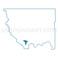
Methow Voting District, Okanogan County, Washington
About
Outline

Summary
| Unique Area Identifier | 687786 |
| Name | Methow Voting District |
| County | Okanogan County |
| State | Washington |
| Area (square miles) | 24.55 |
| Land Area (square miles) | 24.51 |
| Water Area (square miles) | 0.04 |
| % of Land Area | 99.86 |
| % of Water Area | 0.14 |
| Latitude of the Internal Point | 48.14980600 |
| Longtitude of the Internal Point | -120.00472670 |
Maps


Graphs
Select a template below for downloading or customizing gragh for Methow Voting District, Okanogan County, Washington


Neighbors
Neighoring Voting District (by Name) Neighboring Voting District on the Map
- Black Canyon Voting District, Okanogan County, WA
- Carlton Voting District, Okanogan County, WA
- Libby Creek Voting District, Okanogan County, WA
- Pateros Rural Voting District, Okanogan County, WA
- Rat Lake Voting District, Okanogan County, WA
- Starr Voting District, Okanogan County, WA